"This application is an attempt to integrate all the systems working within the ministry, the Upstream Oil and Gas Regulatory Special Task Force (SKK Migas), as well as the Downstream Oil and Gas Regulatory Agency (BPH Migas)," Minister of Energy and Natural Resources Ignasius Jonan said in Jakarta.
The technology is aimed at helping the ministrys information center optimize its budget for documenting all operational activities, including mining, drilling, as well as building plants and infrastructures.
Hence, the ministry could maintain its information system more effectively and efficiently.
This integrated system is expected to improve the data validity and reliability, because in some cases, several bureaus had different information on a similar account, the minister added.
He further explained that the application was also aimed to help all policymakers, stakeholders, and businessmen who are willing to improve their investments in Indonesia.
Following the ministrys "One Map Policy" program, the application is an implementation of the countrys economy scheme VIII which has three missions such as integrating working procedures, allocating incentives for aviation industry, and accelerating the building of the new oil rigs.
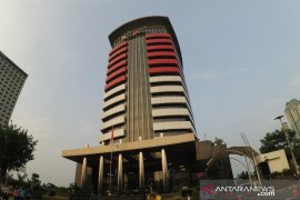
The application, moreover, is part of the joint program set jointly by the ministry and Corruption Eradication Commission (KPK) that aimed to launch an integrated supervision system.
Reported by Afut Syafril
(Uu. KR-GNT/INE)
EDUTED BY INE
(UU.KR-GNT/B/KR-BSR/S012)
Editor: Aditia Maruli Radja
Copyright © ANTARA 2017


