Despite Mount Agung showing increased activity, 98 percent of the tourist attractions on Bali Island remain safe for visit, the Bali Tourism Board stated.Jakarta (ANTARA News) - Thousands of Balinese evacuees returned home after living more than a month in evacuation centers on the Island, following the decision of the Indonesian authorities to lower the alert status of Mount Agung from Level 4 (dangerous) to Level 3 (high alert) on Oct 29, 2017.
"According to the images observed by the drone, the magma activity has dropped for the last nine days, and the volume of ashes ejected from the crater has decreased," Kasbani, head of the Energy and Mineral Resources Ministrys Volcanology and Geological Hazard Mitigation Center (PVMBG), said in Karangasem District, recently.
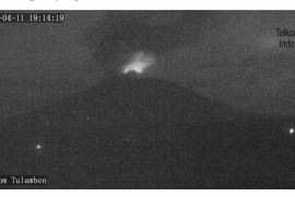
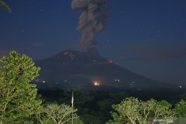
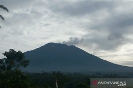
Located in Karangasem, Bali Island, the 3,142-meter-high Mount Agung has been rumbling since August, but the volcano has not yet erupted.
In the last two months, the officials had recorded the activity of the volcano to be high. "(However), for the last three days, the tremors were stable from 100 to 200 shocks per day," he remarked.
Apart from the tremors, the GPS-based observer and tiltmeter have pictured that the deformations at the crater were slowing down.
"There is no pressure (in dropping the volcanos alert status). Our decision is based on some observations on the craters deformation and other indicators," he explained.
Since PVMBG declared the highest alert level of Mount Agung, about 144,389 people living in the affected zones in Karangasem, had been evacuated to several regions, including the neighboring districts of Klungkung, Buleleng, Bangli, Gianyar, and Denpasar.
The Klungkung disaster mitigation office (BPBD) has facilitated the return of the evacuees to their respective homes.
"We did not force them to return home, and they can stay at the refugee camp for as long as they want," Putu Widada, head of the local BPBD, stated in Bali, on Oct 30.
The office deployed five buses and three trucks to transport a total of 3,758 evacuees back to six villages, namely Buwana Giri, Sebudi, Besakih, Jungutan, Dukuh, and Ban, in stages.
A total of 134,500 people are currently taking refuge in eight districts and one municipality city in Bali.
Sutopo Purwo Nugroho, spokesman of the National Disaster Mitigation Agency (BNPB), remarked that many residents are still staying in the dangerous zones.
"Thousands of people have returned home in red zones. Some of them are at home only in the afternoon," he revealed.
Following the stage III status of Mount Agung, the Bali Disaster Mitigation Agency (BPBD) said that it would evaluate the further condition on some disaster-prone areas (KRB) situated at the foothill of the volcano, Karangasem district.
"For now, there are six villages categorized as the disaster-prone areas. However, not all the neighboring regions are part of KRB. Some villages have been announced as a safe zone," the head of Bali mitigation office, Dewa Made Indra said.
Indra further mentioned the six disaster-prone villages, such as Jugutan, Buwana Giri, Sebudi, Besakih, Dukuh, and Ban.
"However not all regions within the villages are prone to the disaster. Therefore, we are now still maintaining communication with the local chairmen," Indra remarked.
Despite the lower alert status, the emergency status of Mount Agung in Bali Province has been extended until Nov 9, to anticipate the threat of the volcanos eruption.
"The extension of Mount Agungs highest alert level is also intended to help meet the evacuees basic needs," he remarked.
The Center for Volcanology and Geological Hazard Mitigation has established a safe zone beyond the 12-kilometer radius of the mount.
Despite Mount Agung showing increased activity, 98 percent of the tourist attractions on Bali Island remain safe for visit, the Bali Tourism Board stated.
"According to information from the National Disaster Mitigation Agency, 98 percent of the tourist areas remain safe in Bali, even if Mount Agung erupts," Dewa Gede Ngurah Byomantara, head of the Boards Bali Tourism Hospitality Division 3, was quoted as saying on the official website of the Indonesian Foreign Ministry, recently.
If the volcano were to erupt, only two percent of Balis tourist attractions -- Besakih, Tulamben, and Tirta Gangga -- would be affected.
"Kuta, Ubud, Nusa Dua, and Sanur are located far from Mount Agung. Until now, we believe that the area beyond 12 kilometers from Mount Agungs crater remains safe," he added.
Earlier, Bali Governor Made Mangku Pastika had convinced tourists to visit the resort island without hesitation, adding that it remains safe and conducive despite the increased activity of Mount Agung, which is located in Karangasem District, Bali Island.
The governor made assurance during a meeting with tourism stakeholders, such as travel operators, in Denpasar, Bali, on Oct 3.
If Mount Agung erupts, it will have a direct impact on only 28 villages located within a radius of 12 kilometers from the volcanos crater.
Another assurance was given by Tourism Minister Arief Yahya, who informed the international public that Bali remains safe for visits, despite the alert status of Mount Agung being raised.
"Bali remains safe for tourist visits by both domestic and foreign travellers. We have taken various anticipatory measures and are well prepared in case of an eruption," he had said on Oct 5.
He stated that only few areas would be affected by the volcanos increased activities, while a large number of tourist destinations in Bali would remain safe.
Several key Balinese destinations, such as Tanah Lot, Uluwatu, Lake Beratan Bedugul, Tampak Siring Palace, Bali Safari and Marine Park, Garuda Wisnu Kencana, Sanur beach, Tanjung Benoa, Goa Gajah, and Nusa Penida, are located quite far from the volcano and not affected by the increase in volcanic activity at Mount Agung.
Kuta Beach, which is some 75 kilometers away from the volcano, is also safe.
Bali has set a target to attract 5.5 million foreign tourists this year.(*)
Reporter: Fardah
Editor: Heru Purwanto
Copyright © ANTARA 2017


