Bahasa Indonesia
Latest News
Popular News
Top News
Home
Current Issue
World
Business & Investment
Explore Indonesia
Article
Antara's Choice
Opinion
Photo
More
Press Release
Infographics
×
Home
Home version one
Home version two
Home version three
Home version four
Pages
Blog
Style 1
Style 2
Style 3
Submenu item 3
Multi level 1
Multi level 2
Submenu item 4
Submenu item 5
Blog single detail
Style 1
Style 2
Style 3
Search Result
Style 1
Style 2
Login
Register
Contact
404 Error
About
Style 1
Style 2
Category
contact
Business & Investment
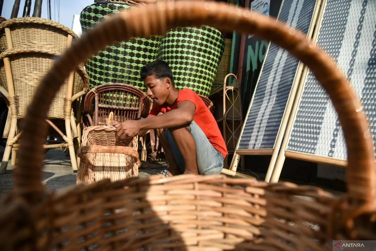
Ministry pushes MSME financial inclusion at APEC policy dialogue
3 hours ago
Current Issue
Optimizing seat at the FATF to combat transnational crimes
4 hours ago
Current Issue
Jokowi visits Mamasa hospital to check HR, health facility
5 hours ago
Business & Investment
OIKN explores potential investors in Hannover Messe
6 hours ago
Business & Investment
Jakarta needs creative financing to develop as global city: Ministry
7 hours ago
Current Issue
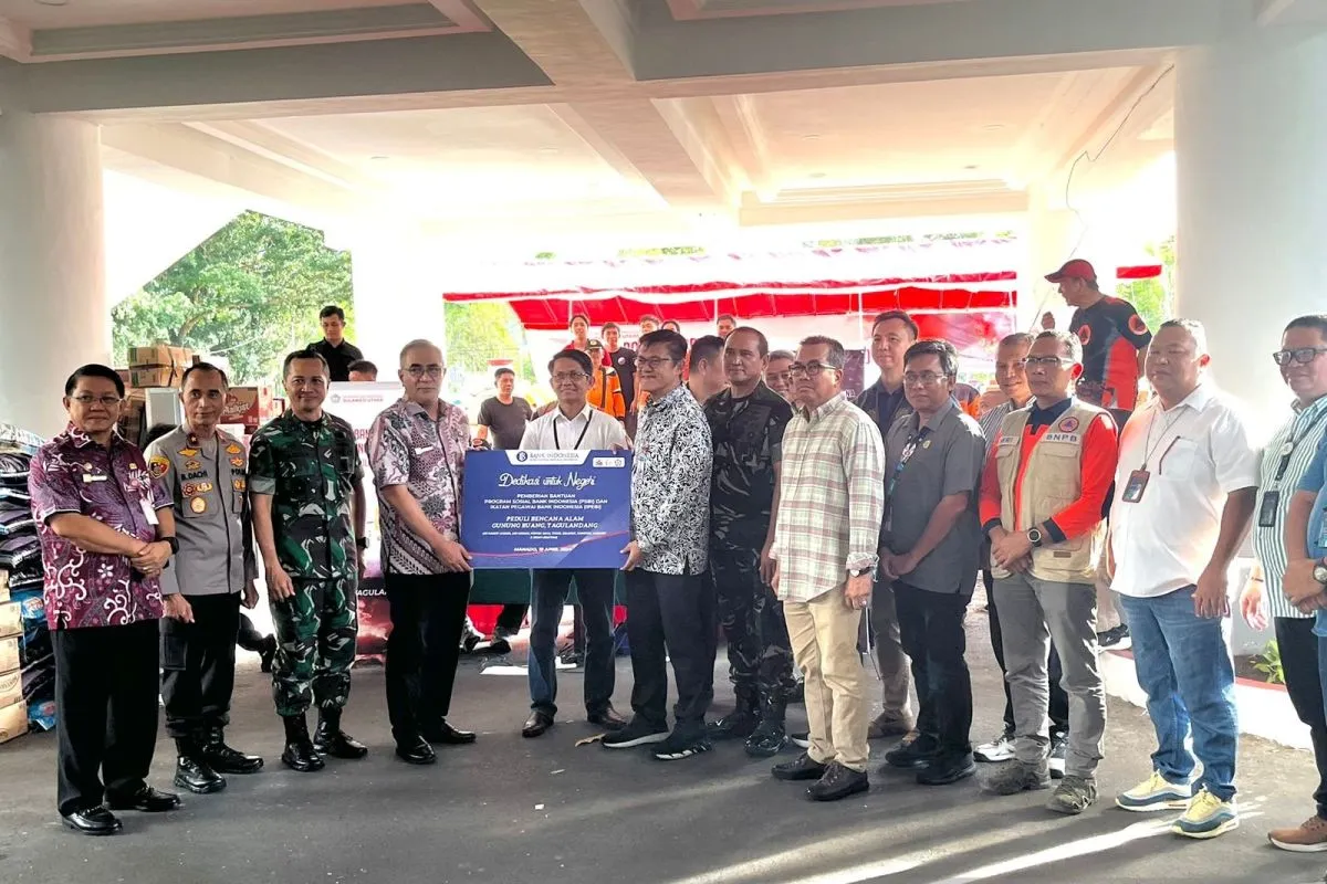
BI provides aid to residents impacted by Mount Ruang eruption
9 hours ago
Current Issue
Jokowi sends electric car to vocational school in West Sulawesi
9 hours ago
Current Issue
Minister Effendy keens to spend final months in office in Nusantara
10 hours ago
Business & Investment
Pohuwato Airport expected to bolster Gorontalo's economy: Minister
11 hours ago
Current Issue
MK's election dispute verdict proves government's innocence: President
11 hours ago
Latest News
Index
Making History: ASPIRE to Launch Inaugural ‘Abu Dhabi Autonomous Racing League’ Redefining Future of Extreme Sport on April 27
1 hour ago
SMART Modular Technologies Introduces New Family of CXL Add-in Cards for Memory Expansion in High Performance Servers
1 hour ago
Ministry pushes MSME financial inclusion at APEC policy dialogue
3 hours ago
Spike in arboviral diseases shows need for vaccine development: expert
3 hours ago
Jakarta must meet economic parameter to become global city: governor
4 hours ago
Indonesia needs global promotion with PR help: minister
4 hours ago
Optimizing seat at the FATF to combat transnational crimes
4 hours ago
Indonesia pushes to accelerate digital economy development
4 hours ago
EIG’s MidOcean Energy Completes Acquisition of 20 Percent Stake in Peru LNG
5 hours ago
Elon Musk's Starlink should follow Indonesia's rules: Minister
5 hours ago
Jokowi visits Mamasa hospital to check HR, health facility
5 hours ago
Bali installs traditional 'penjor' on routes passed by WWF delegates
5 hours ago
OIKN explores potential investors in Hannover Messe
6 hours ago
Indonesia joins global initiative on protection of children online
6 hours ago
National anti-drug efforts need to begin from N Sumatra: BNN
6 hours ago
Indonesia offers irrigation, hydropower projects at World Water Forum
6 hours ago
Current Issue
Indeks
Spike in arboviral diseases shows need for vaccine development: expert
3 hours ago
Jakarta must meet economic parameter to become global city: governor
4 hours ago
Indonesia needs global promotion with PR help: minister
4 hours ago
Optimizing seat at the FATF to combat transnational crimes
4 hours ago
Business & Investment
Indeks
Ministry pushes MSME financial inclusion at APEC policy dialogue
3 hours ago
Indonesia pushes to accelerate digital economy development
4 hours ago
Elon Musk's Starlink should follow Indonesia's rules: Minister
5 hours ago
OIKN explores potential investors in Hannover Messe
6 hours ago
Explore Indonesia
Indeks
This Bandung building has stood the test of time
30th March 2024
A story about preservation of Papuan local cuisine
21st March 2024
Aligning "Bau Nyale" tradition with Mandalika SEZ development
29th February 2024
Indonesia begins population survey to track more Javan leopards
27th February 2024
Article
Indeks
Preserving a balance between development and biodiversity in Nusantara
9th April 2024
Journey of Azerbaijan's city of Shusha to regaining its lost status
4th April 2024
Green open spaces in Jakarta produce hundreds of kilos of chilies
30th March 2024
Green open spaces improve quality of life in Jakarta metropolis
23rd March 2024
World
Indeks
Indonesia highlights sustainable tourism efforts at UNGA
17th April 2024
China's FM to visit Indonesia to intensify bilateral ties
17th April 2024
RI's badminton players need to secure seed positions before Olympics
12th April 2024
FM Marsudi calls for international solidarity for peace in Palestine
23rd March 2024