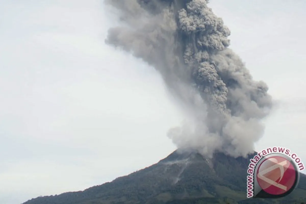
Head of Data Center of the National Disaster Mitigation Agency (BNPB) Sutopo Purwo Nugroho said in a short text message that the first eruption took place at 2:40 am belching volcanic ash some 2,000 meters into the air.
The second eruption took place at 4.05 am with volcanic ash flying 1,000 meters in a northwest direction.
Meanwhile, the third eruption occurred at 6:19 am, with ash reaching 2,500 meters heading in a northeastern direction.
According to a report from the Vulcanology and Geology Disaster Mitigation Center (PVMBG), Mount Sinabung still has high potential for follow-up tremors.
It has been spewing glowing lava during the past three days, so its eruptions are likely to become more dangerous. The character of its eruptions has been the same as that of Mount Merapi in Java.
The PVMBG still maintains the Moutn Sinabung alert status at level 3, which means local residents have to abandon the surrounding areas in the radius of 3 kms.
Villagers from seven hamlets, namely Desa Mardinding, Desa Gurukinayan, Desa Sukameriah, Desa Berastepu, Desa Gamber, Desa Bekerah, and Desa Simacem have been recommended to evacuate.
However, residents of a number of other villages, which have not yet received recommendations, have also vacated their homes, fearing ash and sand rains. These villages include Desa Temberun, Desa Kotatonggal, Desa Sigarang Desa Sukanalu and Desa Kutatengah.
Mount Sinabung has been erupting since the beginning of this month. A total of 5,962 people living near Mount Sinabung have been evacuated.
Those affected by the disaster have left their homes and plantations to live in temporary shelters. Most of them are farmers growing vegetables and fruits, such as chilli, tomato, orange and citrus.
"The government and local banks are considering rescheduling the maturity of credits extended to farmers. If necessary, we will give them more credits to enable them to rebuild their businesses using the credit fund after the disaster," Coordinating Minister for Peoples Welfare, Agung Laksono, said here on Sunday.
Volcanic material spewing from Mount Sinabung on November 12 destroyed 1,893 hectares of citrus plantations in Tanah Karo and impacted fruit production.
"The number of damaged citrus plantations may increase as the data was only gathered from five sub-districts located near Mount Sinabung," the Head of Karo Districts Agriculture Office, Agustoni Tarigan, said on Wednesday.
The 1,893 damaged plantations are located in five sub-districts, namely Merdeka, Berastagi, Namanteran, Simpangempat and Payung.
In fact, data from the local agriculture office show there are around 14,000 citrus plantations in Karo District.
Low production is estimated to last until next year, as the effect of the volcanic material will be felt during the next harvest.
The local administrations plan to rejuvenate damaged citrus plantations will have to wait until Mount Sinabungs eruptions have stopped.
Mount Sinabung has erupted several times since September this year. The volcano, which is located 2,460 meters above sea level, erupted again on Sunday at 3:58 pm.
Karos administration has set aside a budget to provide 165,000 citrus seedlings for local farmers to enable them to replace old trees.
"Providing the seedlings is one of the efforts being made to conserve and develop one of Karos typical fruits, as many of the citrus trees were old and suffering from diseases," Tarigan stated.
(EDITED BY INE)
(A014/KR-BSR/O001)
Editor: Jafar M Sidik
Copyright © ANTARA 2013


