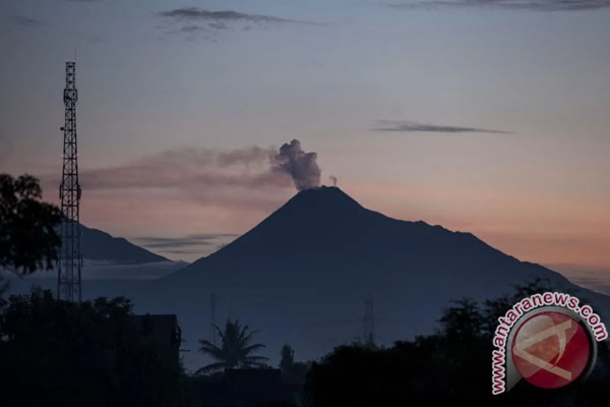
On the same day, several loud booms were also heard within an eight kilometer radius from the Mount Merapi peak."Jakarta (ANTARA News) - The status of the two most active volcanoes in Java Island, Mount Slamet and Merapi, were raised by the authority on Wednesday following increasing volcanic activities.
The Geology Disaster Technology Development and Research Center (BPPTKG) of Yogyakarta raised the status of Mount Merapi from normal (alert level I) to waspada (alert level II), while Mount Slamets was raised from alert level II (Waspada) to alert level III (Siaga).
Chief of Yogyakarta BPPTKG Subandriyo said here on Wednesday the volcano, located at the border between Central Java and Sleman, Yogyakarta, recorded 20 low-frequency tremors on April 29, which was predicted as an indication of the increasing volcanic gas flow that had the potential to cause an eruption.
"On the same day, several loud booms were also heard within an eight kilometer radius from the Mount Merapi peak," Subandriyo said.
Between April 20 and April 29, 2014, there were 37 avalanches, 13 multiphase tremors, four blasts or phreatic explosions, 24 tectonic tremors and 29 low-frequency tremors at the volcano.
The increased status of the mountain, therefore, meant that no hiking or climbing will be allowed, except for research or for disaster mitigation efforts.
"We also asked residents living near the Mount Merapi slope not to be provoked by rumors about the volcanos eruption but to follow instruction from the local authority," he added.
There was no evacuation order from the authority in the current volcanos status.
"We asked the local authority to socialize the condition of Mount Merapi so that residents get the correct information," he said.
The BPPTKG of Yogyakarta will intensify the observation on Mount Merapi following its increasing volcanic activity.
The last major explosion of the most active volcano in Indonesia occurred in 2010.
The eruption began in late October 2010 and a series of eruptions continued into November.
Over 350,000 people were evacuated from the affected areas and at least 353 were killed during the eruptions.
Meanwhile, The Volcanology and Geology Disaster Mitigation Center (PVMBG) raised Mount Slamets status on Wednesday at 10:00 a. m. local time (GMT+7) following the increase in volcanic activity.
Chief of Information and Data Center of the National Disaster Mitigation Agency (BNPB) Sutopo Purwo Nugroho said on April 29, between 12:00 a. m.-06:00 a. m., 30 eruption quakes, 67 quakes from the blasts, and 26 loud booms were recorded in Mount Slamet by the agency.
The volcano also spewed a thick brownish white smoke 150-700 meters high and lava that flowed to a 1,500 meter radius from the mountains peak.
"Swelling of the ground around Mount Slamet can be seen from observation posts in Cilik and Buncis. It shows that the volcano is inflating," Nugroho said.
The agency issued a recommendation of an exclusion zone of four kilometer radius. No camping, hiking and tourism activity will be allowed within the radius.
There is no evacuation order as the villages around the volcano are still outside the exclusion zone. Peoples activities remain normal.
The nearest village, Jurang Mangu of Pulosari Subdistrict of Pemalang, is located 10-12 kilometers from Mount Slamets peak," Nugroho said.
The BNPB is coordinating with regional disaster mitigation agencies (BPBD) of five districts located around Mount Slamet, Pemalang, Banyumas, Brebes, Tegal and Purbalingga, for mitigation measures and socialization to the society.
(Uu.A059/INE/KR-BSR/F001)
Editor: Priyambodo RH
Copyright © ANTARA 2014


